Measuring an area/structure of interest can be highly time-consuming with conventional methods. 3D laser scanning takes hundreds of thousands of measurements with incredible precision and accuracy every second. These measurements are grouped into a point cloud which enables the client to fully utilize, visualize, and edit the data in CAD. The capacity to quickly gather high-accuracy data means significant time and productivity savings, which is critical when delivering results to a client.
3D laser scanning is a quick and efficient way to collect large amounts of survey data with high accuracy. Scanning is used to measure and model bridges, buildings, quarries, utilities, industrial upgrades, monitoring movement, and accident or crime scenes.
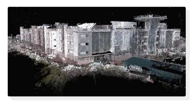
The 3D point cloud data is registered and geo-referenced to create an accurate 3D model of the area or structure specified by the client.
Field surveys used to take days or even weeks to complete. We can achieve the same field surveys in a single day by using laser scanning technology. Thanks to laser scanning, we can also complete flythrough 3D models, detailed animations, and maintenance materials in less time than ever before.
BenDi has a great deal of experience converting Point Cloud Data into BIM platforms like Revit and other BIM software. We create an accurate As-Built Information Model of the building's pipes, walls, slabs, roof plans, facades, and landscapes. LOD 300 to LOD 500 Models for Architectural Elements, Mechanical, Structural, Electrical & Firefighting Elements, Structural Elements, and Integrated Models are all something we've done.
Capturing the as-built environment using 3D laser scanning technology is known as scan to BIM. A Point cloud is the result of the Survey data. The ability of Scan to BIM to analyze the differences between point cloud and model geometry by creating native models is its main advantage.
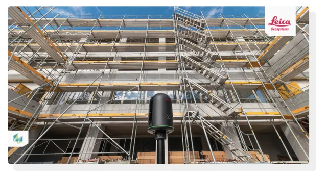
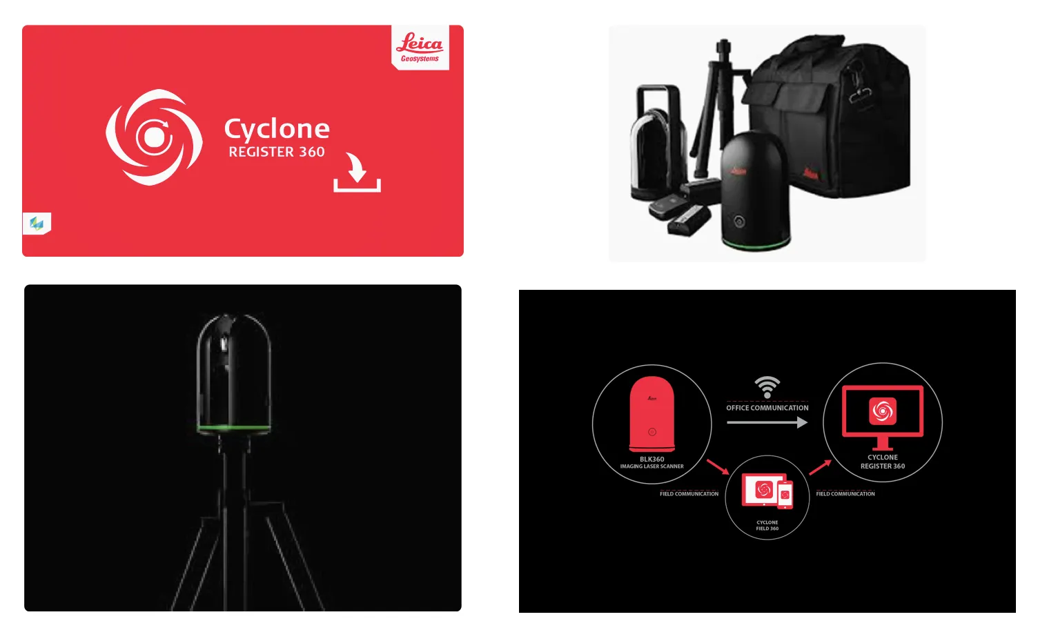
The Leica BLK360 captures the world around you with full-color panoramic images overlaid on a high-accuracy point cloud. Simple to use with the single push of one button, the BLK360 is the smallest and lightest imaging laser scanner of its kind.
Authorised distributor of Leica Geosystems Laser Scanners and Software
BenDi is an early adopter and investor in laser scanning, taking receipt of the first Leica BLK 360 image scanner on the African continent in January 2018.